Error message

Notice: compact(): Undefined variable: return_ssl in template_preprocess_anu_feature_rotator() (line 161 of /var/www/asiapacific.anu.edu.au_maps_online/web/sites/all/modules/anu/anu_feature/theme/anu_feature.theme.inc).

Search maps

Search Tags

Pages

Gulf of Papua

Gulf of Papua

Land abutting the Gulf of Papua showing coconut and rubber plantations.
Country: Papua New Guinea
Hunstein Range WMA

Hunstein Range WMA

Hunstein Range Wildlife Management Area, General Information Map with PNG location inset.
Country: Papua New Guinea
Huon Peninsula

Huon Peninsula

Huon Peninsula, Morobe Province showing main rivers and ranges. Location map included.
Country: Papua New Guinea
Kokoda Track - Owers' Corner to Kokoda

Kokoda Track - Owers' Corner to Kokoda

Port Moresby to Igora focusing on various tracks and locations associated with the Kokoda Track region.
Country: Papua New Guinea
Kokoda Track region

Kokoda Track region

The Kokoda Track region of Papua New Guinea, from Port Moresby to the Solomon Sea.
Country: Papua New Guinea
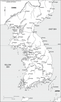
Korea

Korea

Korea, pre WWll, showing main towns, main roads and rivers and 38º parallel.
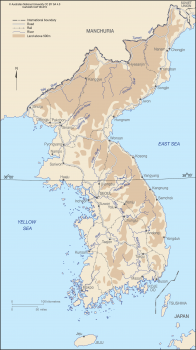
Korea

Korea

Korea, pre World War ll, showing main roads, rail and rivers.
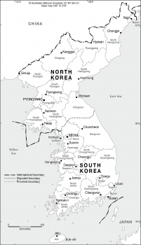
Korea Peninsula base

Korea Peninsula base

North and South Korea with province borders and names, provincial capitals and disputed boundary - 2012.  PNG versions of the base map can be downloaded with or without elevation shading.
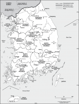
Korea South

Korea South

South Korea provinces and metropolitan areas with major towns and mountains.
Country: South Korea
Lihir Island Group

Lihir Island Group

Lihir Island, also known as Aniolam Island, in the Bismarck Archipelago, New Ireland, PNG showing the sacred Ailaya Rock now surrounded by the Ladolam Gold Mine pit.
Country: Papua New Guinea

Pages

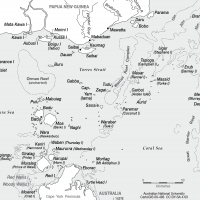
Torres Strait Indigenous Island names

The islands of the Torres Strait identified using the local indigenous titles. [00-483]

» read more

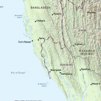
Bangladesh-Myanmar border

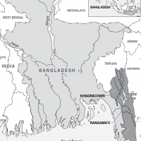
Border region of Bangladesh-Myanmar highlighting Chin and Rakhine state. [00-474]

» read more

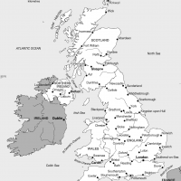
Great Britain and Northern Island

Main cities of England, Scotland, Wales and Northern Ireland. [00-476]

» read more

Feni Islands, New Ireland, PNG

Part of the Bismarck Archipelago, Ambitkle and Babase of the Feni Islands lie east of the southern tip of New Ireland

» read more

Rakhine State, Myanmar

Rakhine State, Myanmar showing the five districts including the newest district of Mrauk-U (formerly part of Sittwe D

» read more

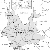
China - Yunnan cities

Yunnan province showing provincial borders and major cities.  [00-473]

» read more

Timor-Leste to Korea

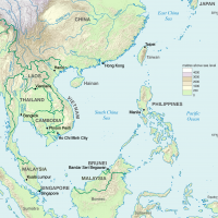
Regional map of east Asia and the west Pacific from Timor-Leste to Korea.   [00-470]

» read more

Chittagong Hill Tracts, Bangladesh

The Chittagong Hill Tracts on the eastern edge of the province of Chittagong. [00-478]

» read more

  • Previous
  • Pause
  • Previous

Updated:  24 January 2022/Responsible Officer:  CartoGIS Services Coordinator/Page Contact:  CartoGIS Services Coordinator